The National Weather Service is watching the track of Tropical Storm Beryl very closely.
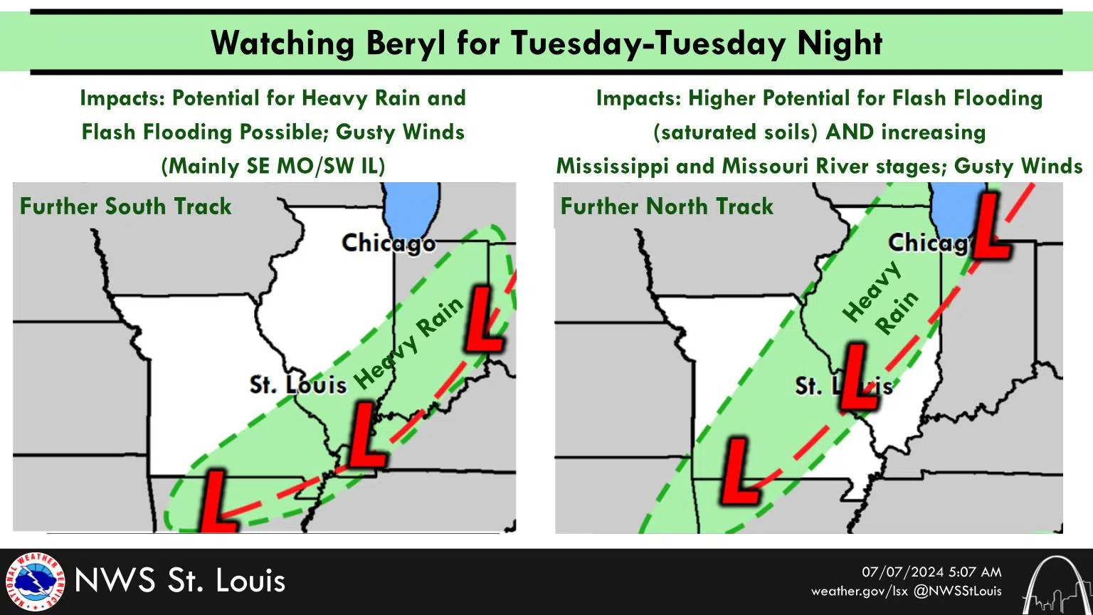
By Tuesday-Tuesday night, the remnants of Beryl may bring the region some impacts, though there is some uncertainty with the track.
A further south track would focus the impacts (heavy rain, potential for flash flooding) in parts of southeast Missouri and southwest Illinois. However, a further north track would bring more of the area heavy rainfall.
Given these areas saw several inches of rain over the past several days, the National Weather says there would be a higher threat of flash flooding. In addition, a more northern track would more heavily impact the Missouri and Mississippi mainstem rivers which are already high due to recent rains.


