The National Weather Service in Paducah is now confirming tornado touchdowns north of Mt. Vernon and north east of Fairfield.
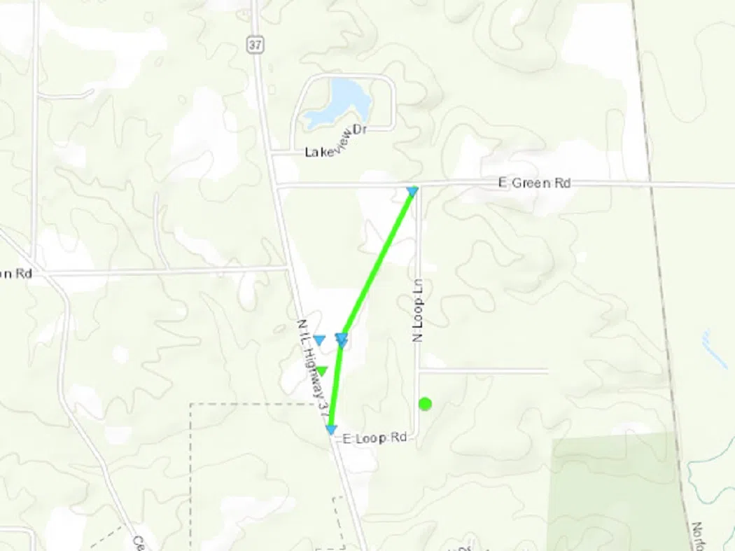
The National Weather Service reported an EF-1 tornado with peak wind speeds of 90 miles per hour struck an area two miles north of Mt. Vernon at 7:32 Thursday evening. The tornado was on the ground for a half mile and had a maximum width of 150 yards.
The tornado uprooted a few large hardwood trees at the start of its track. Two metal buildings at South Central Transit on Route 37 North had most of their roofs removed, all their garage bay doors blown out, and their exterior walls partially removed. Several buses inside the building received significant damage from flying debris. The weather service says building material was pulverized and embedded in the ground and adjacent walls downstream of the start of the damage track with other debris wrapped around trees, fences, and power lines. A nearby building also sustained roof damage.
The weather service feels a microburst with estimated peak winds of 85 miles per hour occurred along the east side of the tornado track. It spread debris from the metal building eastward as it snapped several trees at the base, downed large limbs, and removed roofing material from a home located on North Loop Lane.
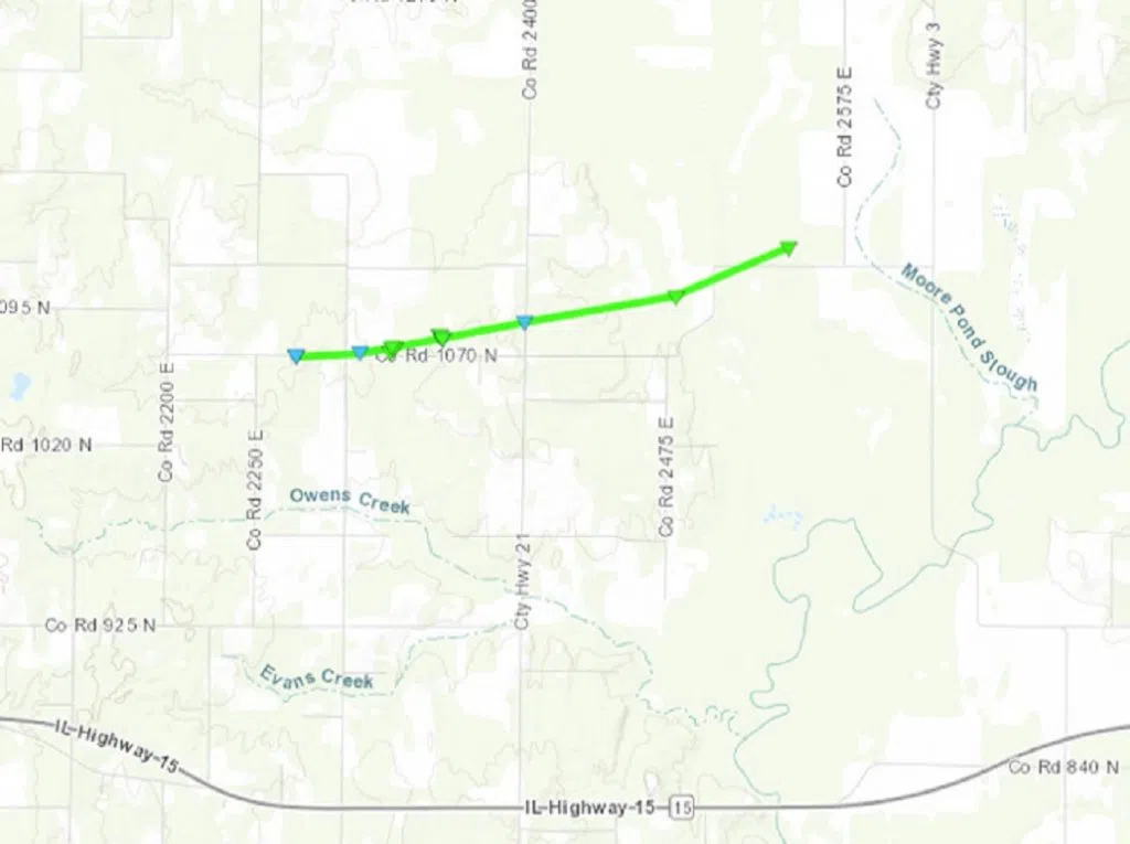
The Paducah office of the National Weather Service confirmed another tornado four miles northeast of Fairfield from 8:11 to 8:15 Thursday night. The tornado was also rated an EF-1 with a maximum wind speed of 90 miles per hour. Its path was traced 2.8 miles with a maximum width of 75 yards. The tornado snapped numerous pine trees near their bases. One home near the beginning of the damage path had about half of its roof damage and an anchored mobile home just to the east was uplifted and tipped but not completely overturned. The mobile home sustained major damage and was uninhabitable. Another home located to the northeast along the tornado path had substantial soffit and porch damage. On the same property, a no longer-used television broadcast tower was toppled and many pine trees had their trunks snapped.
The weather service also reported widespread storm damage along the Interstate 64 corridor across southern Illinois into southwest Indiana. In Washington County, damage was reported to the Assembly Hall roof at Nashville High School. In West Salem, a brick building on the downtown square collapsed as it was buffeted by severe winds.
The National Weather Service in St. Louis tracked four weak tornadoes in the Jersey and Macoupin County area to the northeast of St. Louis. All were E-0 tornadoes. They were in the Jerseyville, Brighton, Fidelity and Carlinville areas.
No injuries were reported in any of the storms.

Thursday night tornado path four miles north east of Fairfield in Wayne County. (Drawing from National Weather Service.)


