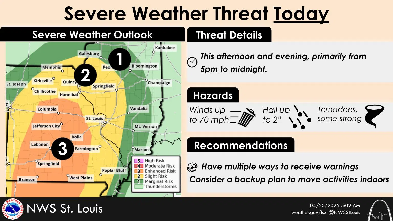
After a break from the rain for most of the day Sunday, the National Weather Service says another round of heavy rain and potential severe weather is possible between five pm and midnight Sunday.
Most of South Central Illinois is listed as marginal risk. Parts of Clinton and Washington County as well as the St. Louis area is in the slight risk category. The greatest chance of severe weather in the region is in Central and Southern Missouri into parts of central Arkansas. The weather service says severe storms could produce 70-plus mile per hour winds, hail, as well as tornadoes.
Locally heavy rain is possible in and around thunderstorms posing an isolated threat for flash flooding. A flood watch remains in effect until one Monday morning.
The Centralia Water Plant recorded another 66-hundreths of an inch of rain in the 24 hour period ending at seven Sunday morning for a two day total of 1.68 inches. One gate of Raccoon Lake is open one and a half feet on Sunday to get rid of excess water flowing into the lake. The lake was six inches below the spillway at seven Sunday morning. Some flooding may occur in the Brewery Hill Road area.
The Salem Water Plant also recorded an additional 66-hundredths of an inch of rain for the period ending at seven Sunday morning for a two day total of 1.57 inches.
Ameren and Tri-County Electric worked through the day on Saturday to get all power restored that was knocked out by the early Saturday morning storm.
