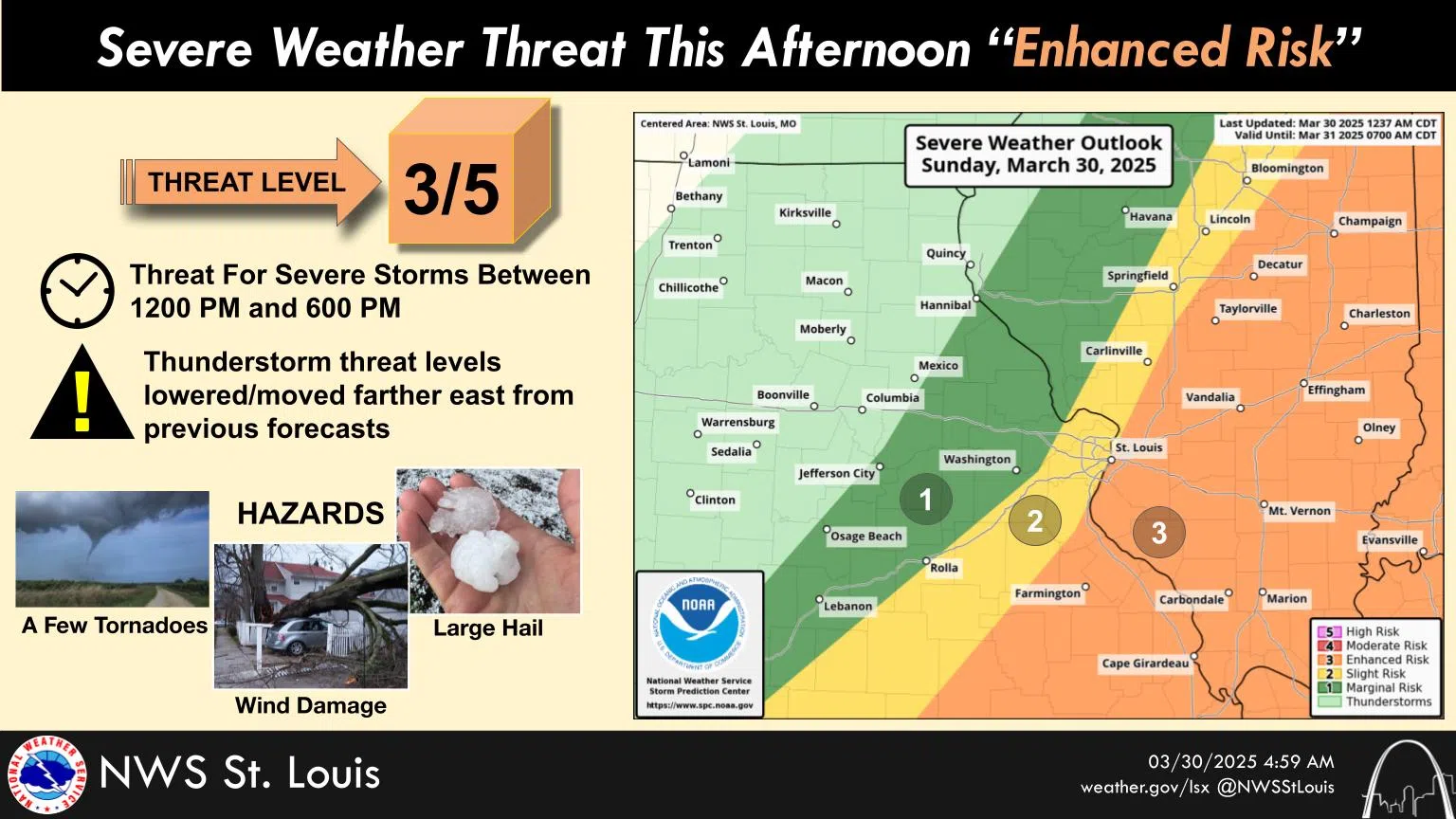
The National Weather Service says South Central Illinois is at a 3 on a 5 point scale for severe weather Sunday afternoon and early evening. The three puts the region in the enhanced category for potential severe weather including strong winds, large hail, and some tornadoes.
The forecast for Sunday is for a 90-percent chance of rain and thunderstorms and a high of 74. A 30-percent chance of rain and thunderstorms continues mainly before seven Sunday night. After the cold front moves through, temperatures will drop down to 41 degrees on Sunday night. The sun returns on Monday with a high of 51. Wind Sunday out of the south at 14 to 18 miles per hour and gusting to 28. Winds changing to the northwest on Sunday night at 10 to 13 miles per hour, gusting to 22 miles per hour. Northwest winds continue on Monday at 14 miles per hour, gusting to 21 miles per hour.
The Salem Water Plant recorded 32 hundredths of an inch of rain from Saturday, and the Centralia Water Plant recorded 22 hundredths of an inch.
